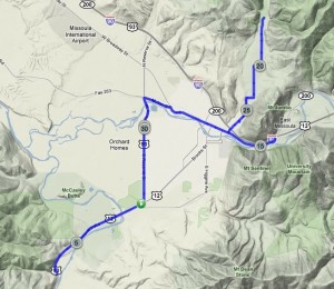
The plan was to bike down 93 to Lolo, Montana, the town just South of Missoula. I’d biked part way there earlier, to get to the Blue Mountain trailhead, so I figured it would be bikeable. I was excited to take Lolo Creek Rd up all the way to the Idaho state line, and to gain some serious altitude (it would have been ~2000 feet up).
But there was one tiny section of Route 93 where the bike lane all but disappeared. I arrived there just as a massive truck was passing by, and I said “No Thanks!” Too bad. Looking at the map later, it really was only about 500 feet where I’d have to get off my bike and walk on the other side of a guard rail. But not knowing that, I decided to turn around and head North instead. I didn’t really have a plan.
I biked into town, then headed East on a road that parallels I-90. Again, I came to a point where I thought I probably couldn’t go further, and looking at a map later, realized that I certainly could have! There is a lesson to be learned here. Either I need to be more optimistic about roads, or just bring a GPS with maps!
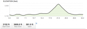
Finally I made a smart choice and bike up Van Buren St to Rattlesnake Drive. That was the most rewarding part of the whole trip, even though it only lasted 8 miles. This was on our last day in Missoula, and I’m sort of sad that I haven’t even scratched the surface of places to hike and bike here.


